Week 6 and 7 Perth Basin Analysis
Geology File
Organise all sheets from this section of work into a separate file. Alternatively you may glue them neatly into your Science Notebook.
You will submit a "hard copy" of your file for final assessment in this topic.
Make an index page and include dates. Number the pages.
Checklist for the index;
You will submit a "hard copy" of your file for final assessment in this topic.
Make an index page and include dates. Number the pages.
Checklist for the index;
- Photocopied sheet setting the geological history of the Perth Basin
- Time-line showing major events from the igneous rock formation of the Darling ranges to the present day
- Geological drawing of the road cutting
- Notes on sand dune formation and cross-bedding
- Copy of Field Work Assignment
- Your notes and drawings following the instructions given in the Field Work Assignment
Task 1 - A expository lesson on the geological history of the Perth Basin.
Task 2 Time line of the Perth Basin
|
Construct a neat time-line showing the geological events from the breakup of Gondwana to the present day.
Use your notes and times from Task 1 as a guide. First make a summary like this... Science Skills 1 Use your skills learned in checkpoints 2 and 3 to construct a time line of events in our Perth Basin. Start with the formation of the granites that make up the Darling Scarp. 600-200 million years ago Breakup of Gondwana. Darling fault forms and western side of the fault drops below sea level Sea levels fall during the last ice age. 7000 years ago was end of this ice age. |
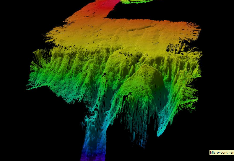
http://www.abc.net.au/news/2011-11-16/fragments-of-gondwana-discovered-off-perth/3673810
Above is a 3D image from the CSIRO. It shows one of the island plateaus found at the bottom of the Indian Ocean. This looks similar to the canyon off the continental shelf of Perth.
If you are interested in continental shelf canyons visit the sites about the Bremer Canyon. Recently there was a documentary on the ABC showing this is a “hotspot” for marine life. The methane released from this canyon forms a reef structure which is the basis of a vibrant ecosystem. |
Task 3 Field Work to draw and interpret the geology of the hill on which the school is built
A note on Geological drawing.
|
|
You will need a plain piece of A4 paper, a sharp pencil and an eraser.
Walk quietly to the field site.
Keep away from the edge of the road cutting.
Walk quietly to the field site.
Keep away from the edge of the road cutting.
- On your paper draw the North arrow to show the direction of North.
- Use most of the area of the paper to draw the features in the road cutting. We will first have a discussion about what you observe.
- Draw a scale, or a figure of a person to give an idea of scale.
- We will discuss the interpretation of the road-cutting. You will need to recall the geological history from the first lesson.
- Use the dropper bottle of acid to place a few drops on the rock material. Describe your observations. Explain the implications.
- Use the trowel to collect some weathered rock material. Place the sample in your white paper bag.
- Note on the bag your names, the date, the site.
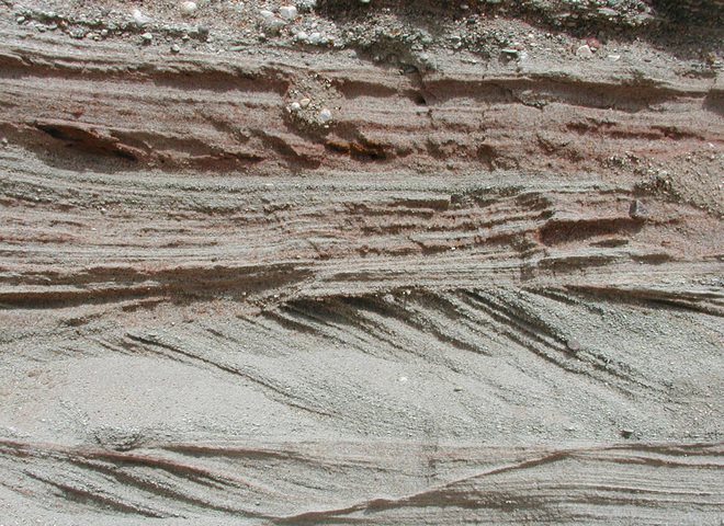
Interpreting patterns in sand
The image below shows a pattern in the sand. Suggest ideas to deduce how this pattern was formed.
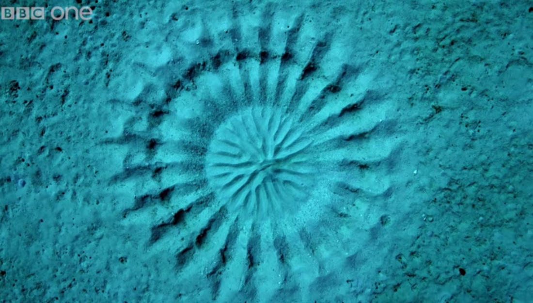
If we can see evidence, then we can understand how the pattern was formed.
This is the reasoning pattern for geologists;
This is the reasoning pattern for geologists;
Task 4 Exploring Cross bedding in sand dunes
“The present is a key to the past” (James Hutton, 18th century Geologist) - natural processes we see happening today (e.g. volcanoes, erosion, formation of sand dunes) also happened throughout geological history.
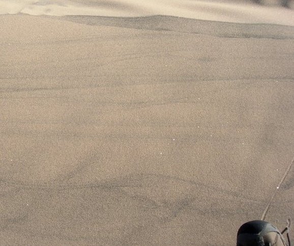
http://0.tqn.com/d/geology/1/0/E/P/1/kelsoprofile.jpg
|
Transverse section through present day sand dunes - Kelso Dunes, Mojave Desert, California, USA.
Describe the structures. Note the scale at the bottom right of image. |
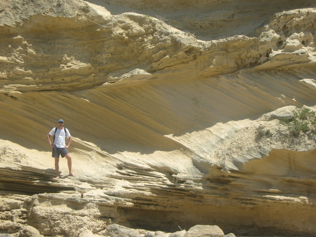
http://www.ndsu.edu/pubweb/~ashworth/webpages/g304/reportphotos2003/cross_bedding_milnor6.jpg
|
Transverse section through compacted sand dunes.
Describe the structures present. Note the scale at the bottom right quadrant of the image. |
|
Transverse section through sedimentary rock that was once dunes. Note the scale.
Compare and contrast this cutting to our rock cutting. Describe the features that are similar to our rock cutting. Describe the features that are different in our rock cutting. |
|

Task 5 Field Work and Geological Interpretation of the road cutting
| 2_6.3_field_work_and_interpretation.docx |
